Use for heating and cooling load calculations or to generally understand the conditions near a site. Guidance:
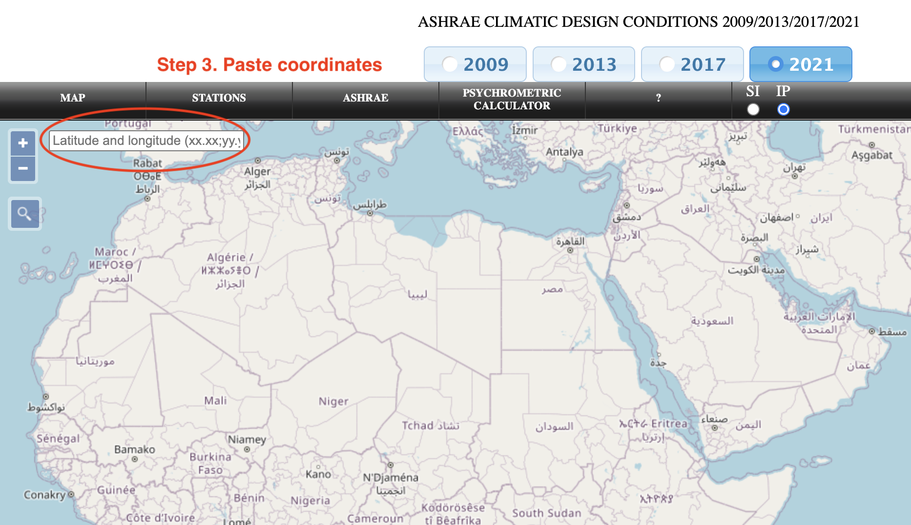
- Select "2017" and "IP" (units)
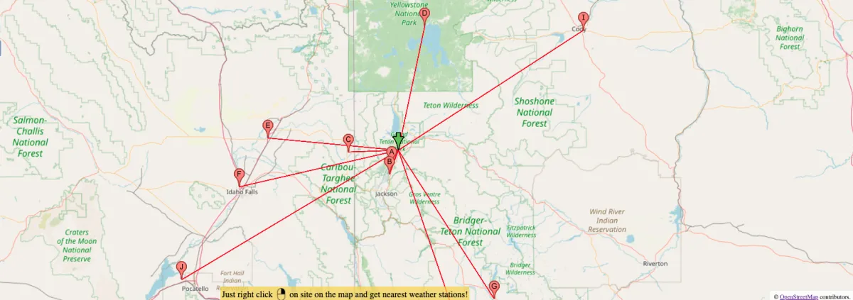
- Scroll and zoom to get to your region of interest, then right click to show nearby weather stations; -OR-
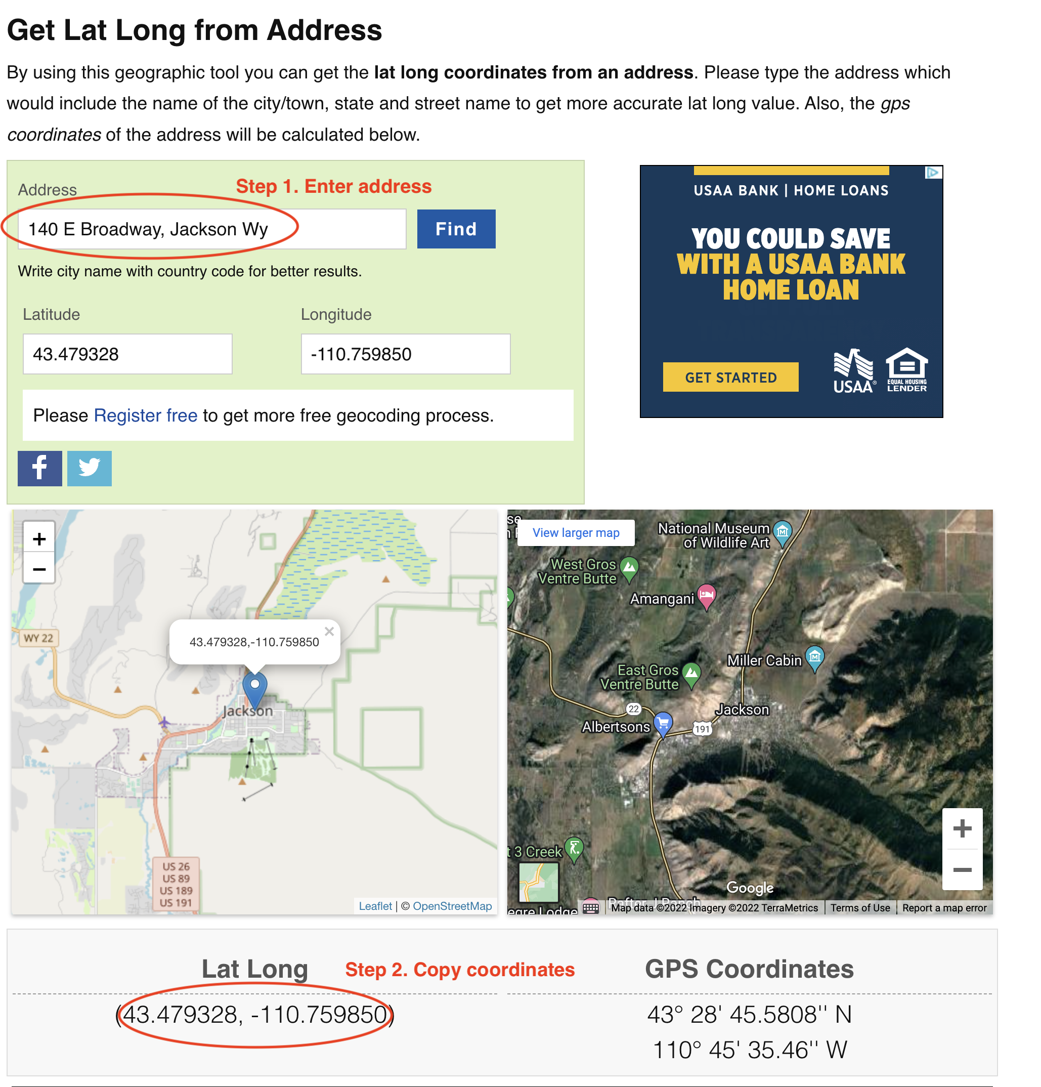
- Get lat/long coords from Latlong.net
- Then paste coordinates in "latitude and longitude" field near top left of ASHRAE tool
- Review weather station options for that best suited for location; note that due to microclimates and elevation differences, the closest station may NOT be the best choice
- Click station of interest (from list at left, or on map) to populate climate data
- Scroll down to see climate data, then copy link or open print-friendly data view by clicking icons at bottom right of the data
Detailed Guidance for Item 2:
Please log in or sign up to comment.